Doc Susie
Winter Park Ski Shop
Ute Bill Thompson

Towns

Many of the towns of Grand County have come and gone with the boom and bust of economic cycles.

Towns Articles

100 Years of Location, Location, Location

Real Estate and land ownership have always been important to the Granby area. With the passage of the 1862 Homestead Act by Congress, the West, including the area around the current town of Granby, began to be settled with hardy, ranching pioneers. The opportunity to own land was often made possible by homesteading.   This lured many settlers to the area.

As Congress adjusted the homesteading rules over the years to allow for larger acreages which would support ranching in the Middle Park, towns began to grow. Ranching, mining and especially the railroad fueled the growth. In 1902, railroad visionary, David Moffat, set events into motion in Denver to build a steam railroad from Denver to Salt Lake City which would be built over Rollins Pass.   This was a monumental task which led to the founding of the town of Granby.

Mary Lyons Cairns observed in her book, “Grand Lake in the Olden Days,” “Granby came into being with the Moffat Railroad, which reached that point in September, 1905. The town site was laid out on a piece of land which was part of a homestead and part of a pre-emption taken up by James Snyder from the government. Mr. Snyder sold this land to David Moffat who had the town site surveyed and platted in 1904, and a man named Hunter auctioned off the lots.”  

The lots on the town plat were 12 blocks and a Block “A.” Each block, except Block 12 and “A,” would have 32 lots. Each lot would be 25 feet by 125 feet. Block 12 only had 20 lots. Block “A” only had four smaller lots. David Moffat and the railroad in the form of the Frontier Land and Investment Company designed the town streets so that the southern boundary of the town was Agate Avenue, the western was First Street, and the northern boundary was Garnet Avenue. A variation in terrain in between Block 12 and Block “A” created Opal Avenue that would lead down Fifth Street which would be the eastern boundary of the new town of Granby.    

The new town streets were named Agate, Jasper, Topaz, Garnet and Opal, all precious gems which might reflect the mining heritage. But, in the King James version of the Bible in the Book of Revelation, Chapter 21, Verse 19, heaven is described as, “And the foundations of the wall of the city were garnished with all manner of precious stones. The first foundation was jasper…” Other streets and foundations are described as being made of precious gems such as topaz and chalcedony. Agate is described in the dictionary as a variegated variety of quartz or chalcedony.   Maybe the founders thought Granby was “heaven on earth.” Or, at least the real estate marketers wanted buyers to think that.

The real estate advertising in the December 16, 1905, Grand County Advocate showed V.S. Wilson as the local real estate agent for Granby. He also was the newspaper editor and became Granby’s first mayor on December 11, 1905. With that background, hyperbole and adjectives must have been in his blood.   “Now is the time to buy property at Granby-The newest and best town on the ‘Moffat Road.’…It would be a Happy Christmas investment. Do it now,” was part of the ad copy.  Mr. Wilson became one of the first land owners in Granby buying lots 18 and 19, Block 7 on Topaz from Frontier Land & Investment in November, 1905.  

When the railroad’s real estate company founded Granby in 1905, local historian, Betty Jo Woods, said the new town location was chosen because it had great connections with the stage route to Grand Lake, was mostly dry ground, and had pleasant views. As they say in real estate, the three keys to successful land investing are “Location, location, location!”   The locations of many of the historic buildings were on the north side of Agate Avenue. According to photographs and written explanations by the late Vera Snider, in 1920, on “main” street, one of the only buildings on the south side of the street was the firehouse which protected the fire pumper and hoses. The post office was also on the south side.   Vera Snider later arranged for the preservation of this historic structure built in 1910 by moving the first post office building in the 1960s from 458 East Agate where it had stood for over 50 years to its present location at 170 2nd Street.

According to the current owner of this historic structure, Deb Brynoff, “When Ron, my husband, was remodeling he found old letters in the wall from when it was the post office building.” It was not unusual during the early years of construction for letters and newspapers to be “stuffed” into the walls to help increase what little “R-factor insulation” existed.    Other early buildings which still exist in Granby are a home at 127 4th Street which was built in 1909. The current Re/Max Granby office at 247 Agate was a home originally built in 1909. Other early Agate Avenue buildings still thriving are Crafter’s Corner at 295 East Agate built in 1913 for the Granby Mercantile. Local lore says the basement was used as a temporary morgue during the 1918 flu pandemic. However, no historic research has yet been found to document this information.  

Research on High Country Motors at 277 East Agate reveal it was originally Middle Park Auto which grew up with the town of Granby. The tax rolls indicate 1913 for the birth of this building. The business was “born” in 1915 when Jack Schliz founded Middle Park Auto. During Granby’s early years this was a hub for locals. It even included a small medical-first aid station inside it before Granby had any local medical services. In 1938, the business was sold to Glenn Pharo and Morris Long. Later, Jack Shield was associated with the business. The authorized Ford dealership was later purchased by Fred Garrett, who later sold it to Mike and Kimberly Garrett.   The only constant on Agate Avenue is change. Many of the buildings have a colorful past. For example, the current location of Brown & Company at 315 East Agate was a Texaco Service Station built in the 1930s.

The Long Branch at 185 East Agate is in a building that was Granby’s first strip mall. That accounts for the many doors fronting on to Agate. Built around 1938 for the Craig’s Café, it has housed Olson’s Café, a Laundromat, a barber shop, The Carpet Wagon rug store and Maureen’s Clothing Store to name a few.   The Silver Spur Saloon & Steakhouse at 15 East Agate used to be the Grand Bar and Café run by Dick and Beulah Samuelson from 1944 to 1964. The original business at this location was the lettuce shed where the famous Granby Iceberg Lettuce was delivered by local growers for shipping to the Broadmoor Hotel in Colorado Springs. Some of the original lettuce shed has been incorporated into this building.  

The Dick Samuelson family also has a history with the Granby Mart at 62 East Agate. This building at one time was the home of Bud and Ken Chalmers’ Auto Repair Shop. In the early 1940s, it had a dirt floor when Sonny Samuelson and his Dad bought it. Clyde Redburn had a bowling alley on one side. The Samuelsons later put in more bowling lanes. Upstairs they had a club called “3.2.” At the time, those 18 and older could sip the 3.2 beer served there and dance. At one time Wayne Snyder’s Saddlery shared half of the store.   Sharing a location was the thinking behind the former Minnie Mall located at 480 East Age. Named by local businessman, Jack Applebee, for his mother, Minnie, in the 1980s, many businesses enjoyed the convenient location, The Furniture Store, Hobby Shop, Montgomery Wards, Honey Bear Children’s Clothing, Fabric Nook, Greg Henry’s Get-N-Pack, Radio Shack, Julie Sneddon’s Cards and Gifts, Patti Applebee’s Nimble Needle, Ben’s Aspen Leaf Café and the Shaft Shop which specialized in darts and dart supplies. Today, Granby Medical Center-Centura Health is at this historic downtown location.  

Granby’s historic story from 1905 to 2005 is one of building dreams, homes and businesses to create a community. Chinese Proverb says, “One generation plants the trees; another gets the shade.” How true.
2005


Fraser
Fraser

The origin of Fraser was in 1905 and it was incorporated in 1953. It was formerly known as Eastom, for George Eastom, who laid out the town site in 1871. The spelling of Fraser was originally Frazier, after Reuben Frazier. The town came into being because it was the site of a large sawmill and was a railroad terminus for the lumbering operation.

While Fraser was generally considered to be an isolated mountain outpost, at one point there was enough cultural interest to support a local opera house.  Fraser was the location of a weather station for several years and during that time it was not uncommon for the winter temperatures to be 45 to 50 degrees below zero; one Fraserite remembers a morning when it was 60 degrees BELOW zero. Thus the town earned the nickname “Icebox of the Nation.” After a legal battle, that offical title went to a town in Minnesota.

A transcontinental motor route dubbed the Midland Trail came through Grand County and by 1913 a Ford sales agency was located outside of Fraser on the 4 Bar 4 Ranch. Avid fly fisherman President Eisenhower was a frequent visitor between 1948 and 1955.

Granby
Granby

Granby was settled in 1904 and incorporated the next year. The town was created along the railroad line being built by Denver, Northwestern & Pacific, and was a connection with the stage route to Grand Lake. The Granby site was also chosen because of the dry ground and and good view of the surrounding mountains.

The town was named in appreciation of the services of Denver attorney Granby Hillyer, who worked to lay out the town site. Its central location makes it a natural trade center for east Grand County. Specialty truck farming, principally lettuce, became a major crop for Granby. At the peak of the market, the Waldorf Astoria hotel in New York City proudly advertised Granby Head Lettuce on its menus. Later, after WW II, Granby was called the “Dude Ranch Capital of the World.” Today the town offers a mix of recreational amenities and residential charm.

Grand Lake
Grand Lake

Grand Lake was established in 1879 and incorporated in 1944. It is named for the largest natural body of water in Colorado.

In 1867, when only a few people resided near the lake, Major John Wesley Powell (the man whose group first rafted the Grand Canyon) came to explore the possibility of floating down the Grand (now Colorado) River. That summer, Powell, local resident Jack Sumner, and William Byers, founder of the Rocky Mountain News, made the first recorded ascent of Longs Peak from Grand Lake.

In the early 1900’s a Yacht Club was formed by enthusiasts who were attracted by the demands of attentive seamanship the lake demanded. In 1912, Sir Thomas Lipton contributed an impressive cup to be presented annually to the winner of the annual August Regatta. This event still draws skilled sailors to the challenging competition. 

The town was founded during a very brief mining boom, but because of it's natural beauty, tourism has long been the sustaining feature of it's economy.

Grand Lake
Grand Lake

Grand Lake was established in 1879 and incorporated in 1944. It is named for the largest natural body of water in Colorado. In 1867, when only a few people resided near the lake, Major John Wesley Powell (the man whose group first rafted the Grand Canyon) came to explore the possibility of floating down the Grand (now Colorado) River. That summer, Powell, local resident Jack Sumner, and William Byers, founder of the Rocky Mountain News, made the first recorded ascent of Longs Peak from Grand Lake. In the early 1900’s a Yacht Club was formed by enthusiasts who were attracted by the demands of attentive seamanship the lake demanded.

In 1912, Sir Thomas Lipton contributed an impressive cup to be presented annually to the winner of the annual August Regatta. This event still draws skilled sailors to the challenging competition. The town was founded during a very brief mining boom, but because of it's natural beauty, tourism has long been the sustaining feature of it's economy.

Historic Granby Real Estate

William Shakespeare, the historic play writer, said, “There is a history in all men’s lives.” The same could be said for many Grand County buildings. According to author, Lela McQueary in her 1962 book, “Widening Trails,” real estate sales and land giveaways helped to build our towns. “In 1905, a town site was obtained from Jim Snider, who had homesteaded the land upon the sagebrush mesa,” wrote McQueary. “The village was called Granby for Granby Hillyer, a civil engineer. Two general stores, two livery stables, a post office and a tiny café (all built with false fronts to make them appear much larger) were scattered on the north side of Main Street, three blocks long.”  That Main Street today is Agate Avenue. A quick search of the Grand County tax rolls reveals an interesting historic mix of buildings.

For example, the current Brynoff home at 170 2nd Street was the Post Office building constructed in 1910 and originally located at 458 East Agate. That building was moved to its current home to make way for the construction for the new Post Office building in 1945 at 458 East Agate. Deb Brynoff, the Executive Director of the Grand County Board of Realtors, said, “When we updated and built onto the original building, we found old letters stuffed in the walls. Obviously, they used them in the early years to add insulating value. I guess they had junk mail even then!”

On July 1, 1966, a new Post Office building was dedicated at 225 East Jasper Avenue (now the current home of the Grand County Library District Administrative Office). According to Granby-area Realtor, Susie Peterson of Glenn Realty, who used to own the building at 458 East Agate when they converted it to the Granby Veterinary Clinic, “Downstairs was full of those neat glass front post office boxes with the gold dials. You can just imagine the history in that building.”  Other buildings constructed in those early years were 127 4th Street in 1909. In addition to a private home, over the years, businesses such as Re/max Real Estate and Katie’s Flower Shop were located at 247 East Agate, which was also built in 1909. In 1910, the property at 110 Garnet was built.
The Roaring 20s saw a spurt of construction such as 172 Topaz (1922), 307 Jasper and 59 4th Street (1924), 166 Jasper and 291 Topaz (1929). The current Columbine Café property at 395 East Agate was built during the heydays of 1927 when it was called the Town Crier Restaurant.

After the Great Crash of 1929 and the Depression of the 1930s, New Deal jobs and loan programs helped fuel new construction. In fact, in 1933, the famous Payne’s Café was built at 365 East Agate. Today, the Greater Granby Chamber of Commerce and Downtown Enhancement offices, along with Noriyuki & Parker law offices are housed in the almost 75 year-old building.

Today’s Shadow Mountain Chiropractic Clinic of Drs. Jeff and Deb Shaw at 60 2nd was built in 1935 as a private home. On April 18, 1935, the first addition to Granby helped the town grow. In 1938, 387 East Agate was the site of the new pool hall run by Alva West. Today Lorene Linke’s Fabric Nook welcomes customers and quilters at the historic location.

In 1938, the building at 185 East Agate, which was Granby’s first strip mall, also was constructed with Craig’s Café, later Olson’s Café. Over the years businesses such as Maureen’s Clothing Shop, a laundromat, a barbershop and the Carpet Wagon found homes where today the Longbranch and Schatzis Pasta & Pizza Restaurants are found.

Post World War II America and Granby boomed. Granby had an influx of new residents because of the continued construction of the Granby Dam and the Colorado Big Thompson Water Project. In 1946, the Granby Dairy Building at 106 Jasper sprung up. That same year, Carmichael Real Estate Company built a new office at 191 East Agate. Today real estate is still king at that corner building with the Grand County Board of Realtors and The Title Company of the Rockies offices located there.

The Granby landmark, Frontier Motel, at 232 West Agate was built in 1951 by Earl Saylor. In 1954 Jenkins & Fulk began construction of the Granby Trading Post at 231 East Agate. Ken and Debbie Eaker and Jay Young bought that property in May 1995 and renamed the store, The Grand Mountain Trading Company.  

Hot Sulphur Springs
Hot Sulphur Springs

Hot Sulphur Springs was founded as the first town in Grand County around 1870.  By 1903 it gained incorporation. The hot springs in the area were considered a healing and sacred place by the Ute Indians long before the white man discovered them.

The town site was once owned by William N. Byers, founder of the Denver newspaper, the Rocky Mountain News. Planning to build a town to take advantage of the springs, he first had to construct an enclosure around the main pool to keep the Indian ponies out and the steam in. The white settlers and travellers were drawn to the  springs for their therapeutic value.

During the Christmas season of 1911, Hot Sulphur Springs hosted the first Winter Carnival west of the Mississippi.

Except for a brief period in the early 1880’s, the town has been the county seat.  The Grand County Historical Museum there draws many visitors to its unique displays.


How Parshall got its name

A question frequently asked of native-born son, George Mitchell. It has long been believed that Parshall was named after Ralph Parshall of the Parshall Flume invention fame. But recent research in the Grand County Historical Archives at the Pioneer Village Museum, and with the help of Tim Nicklas, former museum manager, has proved this to be wrong. Daisy Jenne began gathering historical artifacts and memorabilia from the early 1900s. She reports in her records that Alonzo Polhamus named the town for his good friend, Clyde Parshall, son and heir of Cordelia Parshall, owner of the ranch. Polhamus surveyed sixty acres of the flat above the confluence of the Williams Fork and Grand Rivers into lots and blocks and registered the town plat in the Grand County records on July 26, 1907. The following is an excerpt of the upcoming Parshall History Journal. Please note the dates and timeline to verify the events that have led to this correction.

The Other Parshall “legend" says that the town of Parshall was named in honor of Ralph Parshall. However, numerical evidence does not support this legend. Ralph may have been a relative but was not a member of the family that purchased the property that later became the townsite of Parshall. A grave marker in the Golden, Colorado cemetery shows that Cordelia M. Parshall was born in 1862 and died in 1904. She purchased the property from Frank Byers in 1902. According to the 1900 census, Cordelia was married to Simon E. Parshall. The pair had one son, Clyde. Ralph Parshall was born in 1881. He enrolled at Colorado State University in Fort Collins, Colorado as a freshman in 1899 and graduated in 1904 with a degree in Civil Engineering and Hydrology. After post-graduate work, Ralph joined the faculty in 1907 at age twenty-six. Six years later he joined the USDA Irrigation Office, while still part of the CSU Hydrology Department. In 1915, he invented the Parshall Flume, a water measuring device for the purpose of accurately gauging the stream flow of irrigation water, and registered it in the U.S. Patent Office in 1921. He is credited with establishing the Hydrology Lab at the University. Ralph Parshall died in Fort Collins in 1959 at age 78.”


by Barbara Mitchell - GCHA Board Member and 2018 Pioneer of the Year 

Kremmling
Kremmling

Kremmling started as a general mechandise store, owned by Rudolph (or Kare) Kremmling, on the ranch of Dr. Harris, located on the north bank of the Muddy River. In 1888, John and Aaron Kinsey had part of their ranch platted, calling the site Kinsey City. Kremmling moved his store across the river from the new site and the town that subsequently developed became known as Kremmling. There was a post office established at Kremmling as early as 1885 and the town was incorporated in 1904. 

The Middle Park Fair was established here in 1912. Famous Western Novelist Zane Grey spent time in Kremmling and, as a result, wrote "Mysterious Rider" in which the area is shown as a classic Western setting.

During World War II the town was the location of a prisoner of war camp where German prisoners cut ice that was shipped by rail to other locations.

The local ranching industry, the presence of the railroad and its strategic location at the confluence of the Colorado River, the Blue River, and Muddy Creek made Kremmling a natural location for a town, which still retains the “Old West“ atmosphere.

Monarch & KaRose
Monarch & KaRose

Once upon a time on the land that lies beneath Lake Granby and Shadow Mountain Lake there were ranches, pastures and an almost forgotten town, Monarch.  It is a story that goes back 100 years to the Summer of 1905, and the arrival of train service in Middle Park and promoters who were "honest men, but too visionary and lacking in experience", according to Frank H. Wolcott, a brother of one of the founders.

The Monarch Consolidated Gold and Copper Mining and Smelting Company owned the King and Queen copper mines on Arapahoe Range above the South Fork of the Colorado River.  They felt their assays indicated ore worthy of a mill and arranged to haul in the heavy machinery and proceeded to build a town with cottages, a small hotel, stores, a bowling alley, theater and dance hall.  By 1907 Monarch had a school and post office.  However, records indicate only about $150 worth of copper per year was ever produced.    

Soon the promoters realized a sawmill was needed to provide both timber and cash to support the mine operation. A dam was built creating Monarch Lake at the junction of Arapahoe Creek and the South Fork of the Colorado, and a canal was built to float logs cut near Strawberry Lake to Monarch Lake.  A stern wheel steamer bunted rafts of logs into flumes and canals towards the sawmill downstream in Monarch.

In the spring of 1906, Monarch management obtained a charter to build the Rocky Mountain Railway, a standard gauge, for lumber and passengers, from the Moffat tracks in Granby to Grand Lake, with a spur over an unspecified pass to Walden, in North Park.  The track was laid following the river from Granby to the sawmill, by Japanese and eastern European laborers.  Ranchers along the route, excepting Fred and Frank Selak, quietly granted rights-of way. The only rolling stock owned by the railroad was a small, ancient locomotive and a caboose.  The night before Thanksgiving 1906 the first train rolled into Monarch, and the rails never extended any farther.  There was daily service, and local ranchers could flag a ride or have their packages dropped off.  There were no cattle guards, so the fireman would step off the locomotive, open a ranch gate, and close the gate and hop back on after the train passed through. 

During the winter of 1905-06 a box factory was started. It operated briefly before it was destroyed by fire in the fall of 1908.  The fire forced the mill and railroad into receivership.  Visitors, particularly former stockholders, helped themselves to equipment and entire buildings, but Monarch's core was preserved and developed by Harry L. Dierks of Kansas City into KaRose.  This summer resort was named in honor of Dierks' daughter Katharine Rose.  Other Monarch buildings went to neighboring dude ranches and the bowling alley went to Granby.  

To hold the railroad right-of-way, Ernest Behr restored the locomotive in 1912 to carry parties of fishermen along the river from one pool to another.  Ed McDonald, a dude rancher, ran a Cadillac touring car on flanged wheels on the rails to carry mail, supplies, and passengers to the valley ranches.  Just before World War I the engine and rails were sold for scrap. 

Frank H. Wolcott wrote, "In September 1954 my wife and I drove over the site to discover any signs of Monarch or the railroad...It gave us a queer feeling to realize that substantial things like railroads and buildings that we helped build have vanished.  Was it all a dream?"

Articles to Browse

Topic: Time Line

Statehood

Colorado was the 38th state admitted to the Union, and is known as the “Centennial State” because of its entrance into the union in 1876, one hundred years after the signing of the Declaration of Independence. The Colorado River was named earlier, and is Spanish for “red“, the color of the water that the Spanish explorers observed.

People have been living in Colorado at least 9,000 years. Spanish explorers were here in 1540, but the discovery of gold caused a major population explosion in 1859.

The state consists of 3 topographic zones: plains, mountains, and plateaus. The Continental Divide bisects the state, north to south and there are 54 peaks above 14,000 feet.

Denver is the State Capitol at 5,280 feet, one mile above sea level. Colorado is noted for its waterways and is the only state in the U.S. from which all water courses flow out of the state. Rivers that have their origins in Colorado include the North Platte, South Platte, Arkansas, Rio Grande, and the Colorado with its headwaters in Grand County.

Topic: Biographies
Winter Park Ski Shop, Joyce and George Engel

George & Joyce Engle

Winter Park Ski Shop, Joyce and George Engel

Here is the story of how Joyce and George Engel became legends in Winter Park and Fraser. In 1945, Winter Park Resort hired George Engel as their very first paid ski patroller.  Little could George have known that this job would lead him to his wife, Joyce Hanna, disembarking from a ski train, and together they would call Winter Park and the Fraser Valley their home for life. Along with Joyce and their daughters, the Engel Family would have a lasting influence not only on Winter Park Resort but on the Fraser Valley community as well.

In the year following his hiring as Winter Park’s ski patroller, George Engel took on different responsibilities at the ski area, such as plowing the parking lot and collecting rental fees in the bunkhouse.  Gordy Wren and Frank Bulkley formed Colorado Outings in 1946 and started the ski school at Winter Park.  As director of the ski school, Gordy Wren hired George Engel as a ski instructor. That same year George passed one of the first ski instructor certification exams ever held.  By 1949, the Professional Ski Instructors of America was formed and Engel held pin # 12.

Gordy Wren was busy practicing for the 1948 Olympics and consequently sold his share in Colorado Outings.  This gave George Engel the opportunity to buy into the company and he became director and eventually sole owner of the ski school. George added the Winter Park Ski Shop onto the ski school.  

George met the love of his life, Joyce Hanna in 1951 as she disembarked from the Winter Park Ski Train.  Joyce, with two BA degrees from the University of Colorado, was ready to ski and work.  After dating for three weeks, George proposed to his future bride and business partner. The Winter Park Ski School under George’s leadership, and the Winter Park Ski Shop with Joyce at the helm, became fixtures of the ski area. George and Joyce’s two daughters grew up on the slopes.

Daughters Wendy and Janet tell wonderful stories from when the family lived in an apartment above the Winter Park Ski Shop.  After Winter Park Resort bought the ski school in 1982, they demolished the shop and apartment to make way for the West Portal Station.

Along with skiing, another Engel passion was horses which led to their acquiring 40 acres along County Road 5 where they built Casa de Engel.  From their ranch, the Engels helped to establish the Winter Park Horseman’s Association and the High Country Stampede Rodeo at John Work Arena in Fraser.    Naturally, Janet Engel became a rodeo star. The Engels were also involved with the Middle Park Fair and Rodeo for decades.

As community leaders, the Engels transformed Winter Park Resort and the Fraser Valley. They helped start the Fraser Valley Metropolitan Recreation District, the Winter Park Chamber of Commerce and the Winter Park Sanitation District.  Joyce Engel was a founder of the Grand County Concert Series bringing live classical music to this rural community.  In 1968, George Engel was instrumental in bringing the National Sports Center for the Disabled to Winter Park. The family’s wide-ranging passions enrich all our lives then, now and into the future.   


Topic: Health Care

Health Care

In its earliest days of settlement, Middle Park area residents and travelers doctored themselves using whatever remedies they were able to concoct on the scene of accident, illness, or injury.  The cure might have been a poultice of herbs, bread, oil, mustard, or something called Raleigh’s Ointment.  It might have been a dip in the medicinal springs at Hot Sulphur, a dose of iodine, arnica or vinegar, castor oil, Epsom salts, or any number of other standbys.

The first “doctors” known in the area were Dr. Hilery Harris (1874 or 1876) and Dr. David Bock (1876); both were “self-certified”.  Dr. Harris had a predilection for the treatment of animals, while Dr. Bock treated the medical and dental needs of the people. By the mid-1880s, there were a number of doctors traveling through the area, working for various entities and setting up private practices.  During the mining boom, there were a number of physicians and surgeons in Teller City, which was then a part of Grand County.  

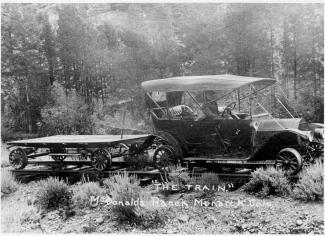
Around 1900, the Dunphy and Nelson Contracting Co, a construction firm building roadbeds through the Fraser Canyon for the Moffat Railroad employed Dr. John Wills as company physician.  By 1903, the Denver, Northwestern and Pacific Railroad employed Dr. Leonidas Wills, cousin to John Wills, for its employees and families.  These types of company jobs provided regular work as well as regular pay for doctors who otherwise would have had little in the way of compensation for their work.

Many of the doctors found themselves moving from community to community as the working community moved--from the Fraser Canyon to the Gore Canyon to lay roadbed, or from one logging area to another.  Later, work flow was based on government projects such as the construction of the Moffat Tunnel and the Alva B. Adams Tunnel, both of which went back to the old tradition of having a company doctor.  By the time of the coming of the Moffat Line to Grand County, most of the communities had drug stores, many of which were owned solely, or in part, by the local physicians. There, people could avail themselves of all types of patent medicines, drugs, toilet articles, soaps, perfumes, and sometimes even a drink at a soda fountain.

It was common for surgery to be done in the home of the patient, or the doctor.  Only occasionally, for the worst of illnesses or injuries, did the doctors attempt to transport patients over the Continental Divide to a Denver hospital.  Childbirth was almost always in the mother’s home, under the watchful eye of a female neighbor, or a midwife, and  rarely with a doctor in attendance.

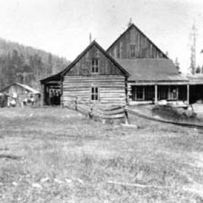
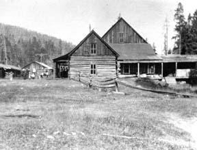
Dr. Archie Sudan built a medical facility in Kremmling and Dr. Susan Anderson remodeled a barn in Fraser to accommodate her patients. Often it was the wife of the doctor, who might be a nurse, who attended the patients.  Many of those in attendance were trained by the doctor in charge; some went on to attain certifications as Registered Nurses or other professionals.

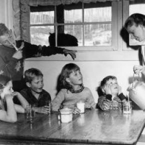
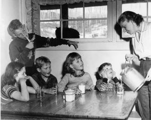
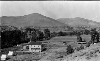
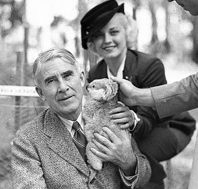
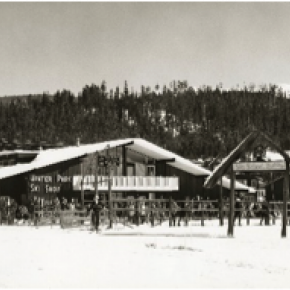
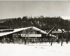
In June, 1947, the Middle Park Hospital Association held a fundraiser to undertake hospital improvement.  The first $20,000 raised went to buy the home/hospital of Dr. Archer Sudan.  In total, the group raised between $35,000 and $70,000 to purchase, remodel, and outfit the facility, which was intended to serve all of Grand County, most of Summit County, and parts of Eagle, Routt, and Jackson counties. The hospital had four private rooms, three wards for six patients each, living quarters for hospital personnel, an office, exam room, operating room and an x-ray room.  Dr. Ernest Ceriani was the first physician for the new facility.

The local rural physicians often called on their colleagues in the city for assistance with difficult cases.  They arranged for specialists to visit, consult and perform surgery, saving the patients and their families hospitalization in Denver.  Just as today, the need for specialized care presented special difficulties for the rural physician of the early days.

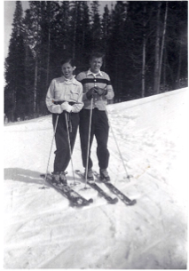
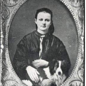
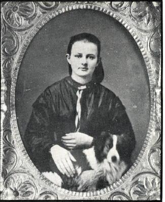
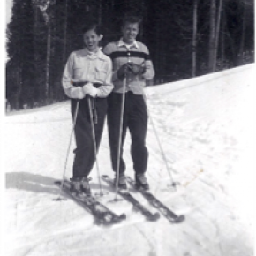
The list of physicians, surgeons, dentists, osteopaths, and veterinarians who served Grand County is lengthy, but the most famous are Dr. Susan Anderson (Fraser), Dr. Archie Sudan (Kremmling), Dr. Mac Ogden (Granby and Kremmling), Dr. Ernest Ceriani (Kremmling), and Dr. James Fraser (Grand Lake).  “Medical Practices in Early Middle Park-Grand County” includes extensive information on each.

Maggie and Jimmy Crawford

Maggie and Jimmy Crawford came to Middle Park in the summer of 1874 with their three children. They were given a piece of property and built a one room sod roofed cabin in Hot Sulphur Springs. They were probably the first family to stay the winter in Middle Park.

As they settled in for a long hard winter, Jimmy continued exploring lands to the west.  He found prime land near a spring that made a unique chugging noise.  That sound reminded him of the steamboats on the Missouri River back home.

After that winter, Maggie returned to Missouri with her family, while Jimmy built a cabin on the new filing, which would later become known as Steamboat Springs, Colorado.

By 1876, Maggie and the children were back in Colorado, and the family became founding members of that new community.
 

The Daily Life of Mountain Men

Washington Irving wrote "There is, perhaps, no class of men on the face of the Earth who lead a life of more continued exertion, peril and excitement, and who are more enamored of their occupations, than the free trappers of the West".

The diet of the mountain men at times consisted of nothing more than meat. When possible. wild plants and berries supplemented needed vitamins.  Pemmican, a meat pounded with fruits and dried in flakes, was convenient to carry and lasted a long time. Mountain men made boudins, sausage made from the intestines of newly killed animals.  These sausages were packed full of undigested grasses which probably protected the mountain men from the illness of scurvy.  The mountain men also chewed on leaves and wild grasses to supplement their vitamin needs.  Potatoes soaked in vinegar supplied further balance to the diet.  Jams and orange marmalade were highly valued whenever they could be obtained. Bread consisted almost entirely of hardtack, a touch cracker usually unsalted, which would not spoil and sturdy enough not to crumble.

Beaver tail soup was considered a delicacy by most mountain men.  Another treat was called "French dumplings", made by mincing buffalo hump with marrow, rolling it into balls, and covering with flour dough and boiled.  Coffee was popular, but limited for transport.  Tea from China came in solid blocks which could be shaved off as needed. 

Normally, mountain men could not carry whiskey on the move but at rendezvous or during visits to forts, they were known as fabulous drinkers.  The most common intoxicant in those days was "Taos Lightening", a strong whiskey manufactured by Simeon Truly of Taos New Mexico.  Various writers have portrayed these men as brutes who lived from one drunken episode to the next, but the facts, and common sense contradict that image.  They could not achieve much in either trapping or trading if they did not stay focused on their outdoor skills and survival. 

Smoking pipes was a luxury, mostly at nights as only a limited amount of tobacco could be obtained.  The mountain men would stretch their tobacco supplies by mixing it with kinnick-kinnick and other plants.

While many traders and trappers dressed in buckskin shirts and trousers, wool garments were even more common and needed to be shrunk to fit.  Probably every mountain man carried what was called a "possibilities bag" that contained personal items such as a pipe, tobacco, soap, needles, and small keepsakes such as mouth-harps.

Before the Sharps "Big 50" rifle was invented, it was necessary to carry a waterproof powder horn and a bag of rifle balls weighing fifty to a pound.  A good knife was essential.  The most sought after of these was the Bowie Knife, invented by Rezin Bowie, but made famous by his brother Jim, who was adept at its use.  Jim was one of the heros killed at the Battle of the Alamo in Texas.

Some mountain men simply loved the lifestyle and had no reason to return to their original homes.  Some had wives back in St. Louis and made an annual trek there every year.  Others had Indian wives or female companions.  Some men claimed to have a wife in every tribe they visited.  Divorce within many tribes was often simple, a matter of putting one's belongings outside the lodge.

As journeys by foot or horse were lonely, mountain men were known to play their mouth harps or sing songs along the trail.  The use of profanity was common, except in the presence of white ladies.  One writer claimed the Indians called white men "Godams" because that swear word was used so frequently by the mountain men, ranch hands and mule skinners.     

Topic: Biographies

Nathaniel "Nathan" Shore

Nathaniel "Nathan" Shore was born in Cottonwood Harbor Canada in 1856. When he was about 16 years old he had visited and then worked as a freighter hauling groceries to different towns in western Colorado. He saved enough money to purchase his own wagons and 2 yoke of oxen for each wagon to continue freighting.

Nathan became famous as a man who carried his Bible in one hand and a gun in the other. Nathan returned to visit his family and met Sarah Jones in Springfield Missouri. They were married in 1885. Their trip to Colorado and the Williams Fork was undertaken with Sarah driving a team of horses pulling a covered wagon and Nathan herding their few cows.

The cows helped start a homestead ranch east of the Williams Fork river. In 1907 they sold the homestead ranch to the Curtis Family. They had purchased the Anders Anderson ranch close to Williams Peak and the Joseph Jackson ranch on Bull Run Creek.

They lived on the Anderson place until the forest fire that burned along the Williams Fork Mountains. Nathan told Sarah to hitch the horses to the hay rack, load the furniture that it would carry, take all the children and move to the Jackson place while he helped fight the fire. Nathan's team of horses were stolen so he broke 3 heifers and a steer to work in the yoke.

He still did a lot of freighting to make a living for his family. He freighted to Hot Sulphur Springs and also from Georgetown. He returned home to the ranch about once a week. He sold butter, that Sarah had made and hung down in the well to keep cold, in the mining town of Breckenridge.

Nathan Shore died June, 1928 when his pickup stalled on a railroad crossing in Utah. He was trying to find the trouble under the hood and didn't hear the train as it whistled and whistled. He was headed for a trip to Hawaii.

Barger Gulch - Archaelogical site

The prospect of discovering a remnant from a 10,000-year-old stone age society that inhabited Colorado's Middle Park so long ago seemed remote at best - while the suggestion that a prized Folsom point could somehow materialize before our very eyes appeared all but impossible.  For one thing, it was the last day of excavating for the summer at the Barger Gulch archaeological site and the ten member scientific team would soon be packing up and heading back to their ivory towers at the University of Wyoming and the University of Arizona.

Barger Gulch is a desolate spot that the federal Bureau of Land Management (BLM) oversees. It is hard, parched dirt dabbled with sagebrush as far as your eyes can see across the flat valley - a haven for all manner of bugs and other forms of native wildlife. In winter, the place turns to the opposite extreme as temperatures plunge to minus 40-degrees and howling winds whip up ghostly images of snow that swirl eerily across the land. This is Middle Park, a high mountain basin with roughly the same geo-political boundaries as Grand County. It encompasses some 1,100 square miles of unforgiving territory flanked on three sides by the formidable wall of the Continental Divide and its terrain soars high over the Great Plains into the thin, alpine air up to altitudes of 13,000 feet above sea level. What would induce these primitive Americans to trek all the way up here without so much as horses for transportation? How would they have survived the brutal winters with only primitive tools and clothing?  And why in the world would they ever want to settle in such a barren, god-forsaken place as Barger Gulch? 

This site could well prove to be one of the most significant archaeological discoveries of its kind in North America, according to BLM officials who oversee the project here. In just three years of work in a relatively small excavation area, investigators unearthed more than 18,000 artifacts - a staggering number ten times that discovered at typical Folsom sites. And this is only one of four sites in the same vicinity.  In addition to Barger Gulch and Upper Twin Mountain, discoveries include the Jerry Craig and Yarmony Pit House sites. Most of these were occupied by peoples described by archaeologists as Paleo-Indians, a catchall term for ancient humans that inhabited North America; Yarmony Pit House post dated Paleo-Indians by about 3,000 years.

But long before Paleo-Indians ever set foot on the Continent, Middle Park was a prehistoric menagerie; 20-million years ago, it was the stomping grounds for prehistoric rhinoceros, three-toed horses, camels, giant beavers, and even small horses. Creatures known as oreodonts also romped across the mountainous terrain. These vegetarians, ranging in size from small dogs to large pigs, fed on grasses and green, leafy plants. In fact, the skull of one of these animals was discovered recently in the vicinity of Barger Gulch. These long extinct, hoofed animals resembled sheep, but were actually closer to camels, and were common in the western U.S. This latest discovery is remarkably well preserved; while the bones have turned to stone, the smooth, hard enamel that encased the animal's teeth is still intact. 

Humans arrived in North America much later - about 12,000 years ago - as the last Ice Age of the Pleistocene Epoch made its exit. These first Americans crossed a land bridge from Siberia to Alaska and began populating the entire Continent; experts believe it is possible they also arrived on boats following the Continental Shelf into North America. Folsom people are best known as nomadic, big game hunters who chiseled out their spear points and finished them off with a distinctive, artistic flourish - a unique groove, or flute, that runs lengthwise along the face that has become the symbol of this Paleo-Indian culture. They honed the tips of these primitive weapons surprisingly sharp for killing frenzies that were necessarily up close and personal: they herded their prey into traps before launching their spears - and archaeologists suspect there was just such a bison ambush site near Barger Gulch. The quarry just over the rise is a gold mine of raw materials, including fine-grained Kremmling chert and abundant Windy Ridge quartzite, which provided a never-ending supply of top grade stone. "It makes sense," explains Todd Surovell. "You would want to camp where you could get as many raw materials as possible within a short distance. That's where you're going to park yourself for awhile."

The bulk of these tools originated with local material, but investigators have found some 200  "exotic" items noticeably out of place at Barger Gulch. One is a distinctive piece of yellow, petrified wood that came from 93 miles away as the crow flies, near the town of Castle Rock on the Colorado plains. Another is a large biface that was brought up from the Arkansas Valley, some 60 miles south. "They worked on it up here in one place and turned it into two, maybe three projectile points," notes Surovell. "One of them broke during manufacture and we have two pieces that fit exactly together."

Fitting these and thousands of other pieces together is what archaeologists do when they get back to the lab. The process begins on site where investigators photograph each find and record its exact location within the excavation block. This gives the team a visual reference to help recognize activity patterns - a way to connect the dots of Folsom society.  But the specks come to an abrupt stop, as if they suddenly run into a solid wall. "If we could figure out that this represented the wall of a structure, that would be really special," he explains. "Nobody's even been able to do that before in a site of this age in North America." Just then, a graduate student pops his head inside the door. "You want to be a camera man?" he asks Surrovell. "What do you got?" "A Folsom point," he replies with a broad grin. We rush over to the site where Waguespack has dug a narrow shaft down the north wall of the excavation pit and hit pay dirt - a Folsom point that remains half buried in the stratum of rich soil.

Rowley & Just Homesteads

Karl and Adella Just homesteaded on Pole Creek in the Fraser River Valley in 1896.  Della was the daughter of Henry Lehman, who had, himself, homesteaded on the upper Grand River about 1880.  Karl and Della worked hard, adding to their property until by the late twenties, they had the largest holding in the valley. 

This lovely ranch was where Snow Mountain Ranch is now, and their log home still stands there even today.  Their several children homesteaded in their own rights.  Della and her son Alfred had what is known as the Rowley homestead, (now part of the Y-Camp) as well as what currently is the Winter Park Highlands.  Son Rudy and his wife Clarabelle ranched part of the original Just property on Pole Creek where they watched over his mother.  Another daughter married one of the Daxton boys and their spread was on Crooked Creek.

Until the 1950's, just beyond Tabernash on the north side of the highway at the foot of Winter Park Highlands stood one of the original log homes of this family. In fact, this house appeared in a 1952 movie called "On Dangerous Ground", starring Ida Lupino, Robert Ryan, and Ward Bond.  It was torn down some years later and a modern house built there.

Life was hard for ranching pioneers, perhaps hardest of all for the women, for they worked in the fields and of course, did all the work of the house as well as much of the garden work.  Little Della raked hay during the season, hoed gardens, hauled water, fished, sewed, and cooked.  She was tough.  The bright spots were when rare visitors stopped by, or as the population increased, dances were held in one town or another.

It was a given that the Just home, like those of most pioneers, had no indoor plumbing.  Nobody expected it and nobody complained.  However, by 1957, Della Just was in her nineties.  Karl was long gone.  Her children decided that she should have indoor plumbing after all these years, and they heard that young Dwight Miller had a brand new backhoe.   When they called, Dwight was pleased at the thought of doing such a useful job.

He brought his machine out to the ranch and prepared to get to work.  He discovered, however, that there was disagreement on this bright idea.  Della thought the notion was silly.  "I've lived all these years with an outhouse and I don't see any reason at all to change!"  

Back in those days, temperatures were very much colder than those currently expected.  Forty and fifty degrees below zero were not unusual at all.  But that old lady didn't mind this.  (No doubt, there were chamber pots available for the worst weather.)

Della's children, themselves no longer young, won out, and Dwight dug the trenches and the septic tank hole and laid the pipes.  We never heard whether Della got used to such luxury or not, but we know that Rudy and Clarabelle agreed that moving into the modern world was a good idea!


Topic: Dude Ranches

Devil's Thumb Ranch

According to local lore, Native Americans named Devil's Thumb, a rocky outcropping that towers high above the Ranch. As legend goes, after the warring Ute and Arapahoe tribes settled their differences in the Ranch Creek Valley, they buried the devil, but left his thumb exposed to remind them of the evils of war.

Before the Trans-Continental Railroad opened up the area in 1904, a stagecoach route from Idlewild (now
Winter Park) joined the Rollins Pass route. A state station was situated east of what is now our Ranch. The road extended transversely over the Ranch where it followed the course of the existing County Road 83. The land was rich agriculturally, and was used for cattle grazing in the early 1900s.

After the railroad was introduced, settlers began moving west in search of wealth and opportunity. Many ended their journeys in the
Rocky Mountains. During this time, there were more people living in the Fraser Valley than there are today. One favorite hangout of the railroad workers was a dance hall on Black Ranch, located immediately north of Devil's Thumb Ranch.

In the 1930s, Margaret Radcliff built the original Ranch homestead and operated it as a dairy. However, it was brothers Dan, Louis, and George Yager who started Devil's Thumb Ranch as a vacation property in 1946. The Yagers incorporated the Radcliff homestead in to the Ranch facilities and the original building exists today as the Ranch House Saloon.

The Yagers operated Devil's Thumb Ranch as both a working ranch and dude ranch until 1972. They introduced cross-country skiing in the winter of 1975-1976. Dick Taylor, a 1964 Olympic cross-country team member, designed 35 kilometers of the area's Nordic trails.

The Ranch was well known as a Nordic destination, but one without many amenities or niceties. The current owners purchased it in 2001, saving it from a group of developers who planned to fill the valley with residences and a golf course. They immediately began making improvements to the facilities, all the while impacting the land as little as possible.

McQueary Family of Middle Park

It has been said that if you walk down the streets of Hot Sulphur Springs and call out "Hello McQueary" at any given time, someone will respond.  Certainly one of the most prolific families to pioneer the Middle Park, the McQueary clan consisted of Scotch-Irish descendents of the immigrants who had settled in the mountainous regions of the Ozarks and the Blue Ridge Mountains.

Henry McQueary and his brother Humphrey, visited the Middle Park area in 1866 while prospecting for gold on Troublesome Creek.  Henry built a cabin on the creek in 1875 and other relatives came to settle including Walker, James, John and George, along with their families.  The families settled near Hot Sulphur Springs and as far west as Muddy Creek and the Gore Canyon.

In 1875, Henry found a Ute Indian with a broken leg near the Troublesome Creek.  He took the man to his cabin and splinted the leg.  After three weeks, the injury healed enough that the Ute could return to his family and that created a friendship that outlasted the Ute uprisings of 1878-1879.

In 1888, Fount McQuearly established a hotel in Hot Sulphur Springs which included a 45 foot ballroom in the Antlers Saloon.  In his later life, he served as County Commissioner (1924).  Many other McQuearys also went into politics, so much so that they were sometimes referred to as the "McQueary Gang".     

"Uncle Walk" McQueary once said that if Andy Eairheart "ever fell into the river and drowned, we'd have to look for his body upstream 'cause he's too stubborn to float downstream!".

Dick McQueary was quite enterprising, establishing a store in Hot Sulphur Springs (1904) and helping newcomers to the area locate homestead sites.  He once was paid with a barrel of china for his services.  Dick also was a contractor for building and maintenance for Grand County and he led the effort to build a road through Rocky Mountain National Park.  This road was eventually finished in 1920 and is known as the Fall River Road.

At least three McQuearys served their country in World War I and fifteen in World War II.  They were also noted athletes; at the 1924 Hot Sulphur Springs Winter Carnival, Margaret McQueary won first place in girls jumping and ski-joring while Milton won first in boys cross country.  

Eventually the McQuearys had over a dozen ranches in Middle Park.


Error message

  • Notice: Undefined index: quantity in omega_views_mini_pager() (line 234 of /var/www/html/docroot/sites/all/themes/omega/omega/inc/theme.inc).
  • Notice: Undefined index: quantity in omega_views_mini_pager() (line 234 of /var/www/html/docroot/sites/all/themes/omega/omega/inc/theme.inc).

Towns